
Survey grade for marine applications. Unlock more detail at further distances than any other system designed for marine survey platforms.

Expand survey capabilities to capture data both above and below water. Install the CL-360 Marine on a survey vessel and leverage standard sonar survey workflow tools, such as CARIS HIPS, for streamlined data collection and processing.
The range accuracy and resolution capabilities of the CL-360 Marine enable users to unlock more detail at greater distances compared to any other system designed for application on marine survey platforms.
The CL-360 Marine is the only survey grade lidar designed for marine applications. What does survey grade mean - here are a few of the specifications that matter.
In practical terms for your survey that means:
With an IP67 rating and corrosion resistant components the CL-360 Marine has been designed with the needs of marine survey platforms in mind.
At 3.5kg, the CL-360 marine can be integrated onto most Uncrewed Surface Vessels (USV) which are capable of being equipped with multibeam sonar. A 10m cable kit also allows the system to be easily mounted on crewed vessels.
The 490m range capability of the CL-360 Marine allows coastal mapping and shoreline verification data to be collected at further distances, staying out in safer and deeper water. While collecting channel data there is potential to capture both sides of channels of nearly 1km width in a single pass.
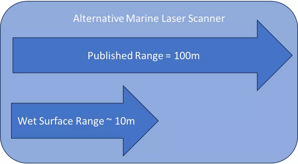
Range also becomes crucial when mapping wet surfaces while inspecting infrastructure. A wet surface can absorb up to 90% of the laser pulse energy, significantly reducing the range at which you can map a wet surface.

| Brochures | |
|---|---|
| CL-360 Marine Datasheet | View and Download the CL-360 Marine Datasheet. |
| The Future of Lidar-Assisted Coastal Survey & Inspection | Discover how better quality data can make a difference - Ocean News |
| Get More out of Hydrographic Survey Missions | Discover the value of adding lidar to bathymetry survey operations - GIM International |
Search for your nearest Teledyne OPTECH office location.
Contact our dedicated ream of technical support specialists anywhere, any time.
Contact sales and request further information about Teledyne OPTECH products and solutions.